
Kent ZIP Evidence by Area
Official King County material verifies several postal codes in records connected with Kent. It does not supply a complete street-by-street post office table. The distinctions in this Kent ZIP code directory are therefore deliberate: strong county evidence is shown as such, while PO-box or special-use leads remain marked for USPS confirmation. Neighborhood labels are kept broad because ZIP lines and local names do not form exact pairs.
| ZIP | Area evidence | Post office status | Research note |
|---|---|---|---|
| 98030 | Kent in an official King County priority ZIP table | Exact station not confirmed | Standard postal area; verify each street |
| 98031 | Kent in county tables and youth-residence data | Exact station not confirmed | Postal and city lines may differ |
| 98032 | Kent in county data | Exact station not confirmed | West Hill and valley context; verify address |
| 98042 | Kent in district reports and county tables | Exact station not confirmed | Kent, Covington-edge, and county geography can overlap |
| 98064 | Kent area shown in a county table | USPS check required | Treat as a postal special-use lead |
| 98035 | Reported Kent PO-box code; official result not captured | USPS check required | Do not assign it to street delivery without proof |
| 98089 | Reported Kent PO-box code; official result not captured | USPS check required | Do not assign it to street delivery without proof |
No official dated Kent ZIP split or realignment was located in the reviewed sources. Exact station names were also not confirmed. That is why the Kent ZIP code directory avoids invented neighborhoods and treats the official USPS ZIP Code Lookup as the address-level postal check.
Note: A failed USPS screenshot in the manifest is not displayed; use the live official form for the current result.
Verify a Kent ZIP at USPS
Enter the full delivery address in the USPS tool. Use the street suffix, direction, and unit exactly. A city-and-state lookup can find broad candidates, but an address result is the better test for a specific property. Save both the five-digit result and ZIP+4 when returned. Then compare the address with the City of Kent's City Limits Tool and the county parcel report.
This sequence answers three different questions. USPS confirms postal routing. The city tool checks incorporated jurisdiction. King County ties the site to a parcel and district record. A clean Kent ZIP code directory search keeps all three answers rather than forcing them into one label.
| Field | Input type | Needed? | Use |
|---|---|---|---|
| USPS Street Address | Text | Yes in address mode | Exact delivery location |
| USPS City and State | Text and selector | Yes in city/state mode | Kent, Washington, or the locality on the mail |
| USPS ZIP Code | Text or returned value | Optional | Five digits or ZIP+4 |
Search Kent Records by ZIP
Local portals do not offer a public one-click list of everyone in a ZIP. King County eReal Property accepts an address or parcel. eMap accepts a parcel number and geographic fields, while a district report returns a ZIP for a selected parcel. My Voter Information matches a known individual using a private three-of-four combination, not a ZIP-wide browse. A current voter-file request may specify lawful election geography, subject to Washington restrictions.
- Confirm the exact postal code at USPS. Keep the standardized address.
- Open the King County Parcel Viewer and locate the address or parcel.
- Read the selected parcel's district report and compare its ZIP with its listed jurisdiction.
- Use eReal Property for the owner, site address, taxpayer mailing address, legal description, value, and sale history.
- If a lawful public voter extract is needed, ask King County Elections for the available geography and terms instead of treating the private voter lookup as a directory.
Once a postal area has narrowed the location, the Kent by-street search gives the proper address and parcel workflow. It is more precise than stretching a ZIP result into a household claim.
Kent ZIP Fields in County Tools
King County's map and property tools work best when the address or parcel identification number, often called a PIN, is already known. The ten-digit parcel number is entered without hyphens or spaces in eMap. Public land survey system fields can also locate land by quarter, section, township, and range. A city levy code may show KENT, but a levy field is not the same as a postal filter.
| County field | Kind | Requirement | Format or meaning |
|---|---|---|---|
| eMap Parcel Number | Text | Alternate search | Ten digits, no spaces or hyphens |
| Quarter, Section, Township, Range | Selectors | Optional alternate | Public land survey fields |
| City Levy Code | Selector or text | Optional | A sample parcel result identifies KENT |
| Map Updated Date Between | Date pair | Optional | Month/day/year |
| District report ZIP | Returned value | After parcel selection | Postal code shown with jurisdiction and districts |
The map can browse parcels and layers, but its public guide does not promise a ZIP-wide resident export. Use it to test a known place. The county result also makes the 98042 quirk visible: one report can show Kent jurisdiction, while another place with the same postal code can sit in county service geography.
Kent ZIPs Versus City Limits
A ZIP boundary serves mail. It does not create a city, voting district, fire district, school district, or parcel line. King County warns that ZIP-based and city-based regions have slight discrepancies. A selected parcel report may show a Kent jurisdiction and 98042 beside several other districts. Another 98042 parcel can show King County jurisdiction. Neither result is a contradiction.
Kent's broad local geography adds one more layer. East Hill and West Hill are largely residential in city planning material, while the Valley includes downtown, the Green River, and much industrial land. County health reports use Kent-Central, Kent-East, Kent-South, and Kent-West. Those labels are useful context, but they are not postal boundaries. Lake Meridian, Panther Lake, and Soos Creek may help identify the right part of Kent when an old notice lacks a modern address.
- ZIP
- A five-digit postal routing code. It is not a municipal boundary.
- ZIP+4
- The five-digit ZIP plus four digits that narrow a delivery segment.
- PO-box ZIP
- A code used for post office boxes, which may not describe street delivery.
- Unique ZIP
- A code assigned to one high-volume organization or site.
- Carrier route
- The delivery path assigned to a postal carrier, not a resident roll.
Three Address Keys for Kent
One parcel can carry several valid address forms. The situs or site address identifies the physical place. The taxpayer mailing address is where tax notices go, and it may be elsewhere. The legal description identifies land by plat, lot, block, public land survey, or metes and bounds. Deeds use parties plus that legal land description. Permits use a project site. Voter records use residential and mailing addresses under their own rules.
Write each form in a separate research note. A ZIP result belongs with the mailing or delivery form. It should not overwrite the site address or the recorded description. This is especially important when a property owner receives mail away from the Kent parcel. The King County eReal Property report exposes the fields needed to see the difference.
Open the official assessor address and parcel search.
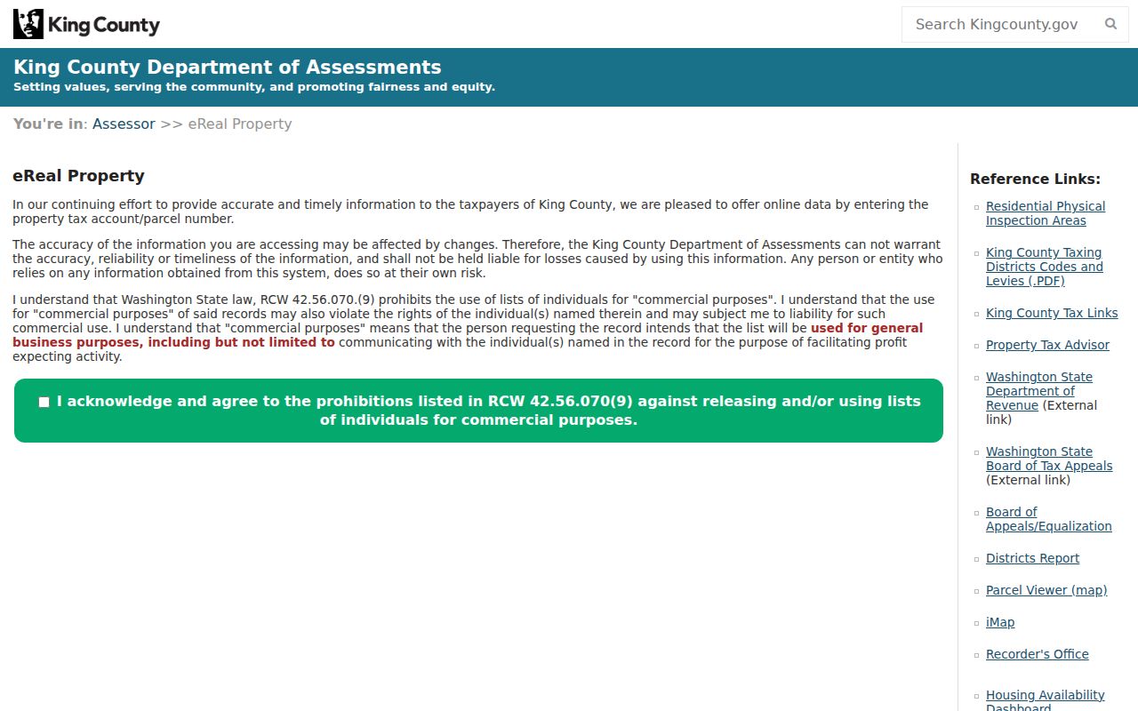
The captured assessor screen supports address and parcel research, but it does not turn a Kent ZIP code into a bulk resident list.
Kent Addresses Before ZIP+4
Historical records may not use the postal form seen today. A 1968 directory can list a rural route, telephone exchange, town label, or abbreviated street. Earlier material may use White River, Duwamish, Titusville, Kent Valley, or a local landmark. Preserve those forms while also recording the modern standardized address.
Search old directories and newspapers with both long and short street suffixes, directional variants, and former place names. Then connect the old reference to a plat, legal description, Sanborn map, census enumeration district, or current parcel. This method is safer than backfilling a modern ZIP onto a historical item that never carried one.
Kent ZIP Directory Limits
A ZIP-wide search can sort public data, but it cannot establish every person at every address. Property rolls name owners and taxpayers, not all occupants. The private My Voter Information tool needs three identity fields and is not a street list. Public voter files have statutory purposes and protected-record exceptions. Utility customer accounts, private delivery lists, and association rosters are not open resident directories.
Use postal codes to narrow a lawful family-history, civic, property, or reconnection search. Confirm each result with its actual custodian and date. Never use address data to stalk, harass, or harm a person. A commercial directory can be stale, while an official record can still answer only the limited question its office was required to keep.
Public-record requests are a fallback, not a shortcut around access rules. Describe the record, office, date range, and geographic field as tightly as possible under the King County public records program. The county gives an initial response within five business days. Inspection is free, while published copy charges can apply. For election data, contact King County Elections and state the lawful political purpose required by Washington voter-file rules. If a portal fails, call the custodian, ask about an in-person terminal, or submit the office's form. A ZIP alone is too broad for many useful searches, so pair it with a record type and date.