
Kent Neighbors in Public Records
No official source publishes a complete household roster for a Kent block. Instead, King County GIS locates each parcel, the Assessor identifies its taxpayer or owner, lawful election channels cover registered voters, and voluntary neighborhood groups supply contacts shared for community work. Older reverse directories and newspapers may show past households, not current residents. The following source map keeps those different claims clear.
| Source | What It Shows About a Block | Access |
|---|---|---|
| Parcel Viewer and iMap | Parcel outlines, nearby lots, map layers, report links | Free map by address, parcel, or click |
| eReal Property | Owner or taxpayer, site and mailing addresses | Free parcel report; Assessor help |
| Voter records | Registration facts subject to protected-record rules | Personal login or restricted lawful request |
| Neighborhood councils | Mapped area, voluntary contacts, notices | City recognition program |
| Block Watch | Voluntary phone tree and safety organization | Kent Police sector contacts |
A parcel owner may live elsewhere. A tenant may never appear on the tax roll. A council contact speaks for a voluntary group, not every household. These distinctions are essential when identifying Kent neighbors.
Click Around a Kent Parcel
The King County Parcel Viewer accepts a complete address, parcel number, or map click. Search the known Kent address, zoom until the red parcel lines are clear, then select the subject lot. Its popup links to eReal Property and the Districts and Development Conditions report. Move one lot at a time to the left, right, across the road, and behind the property. This creates a small block set without pretending the map offers a resident-name export.
The official Parcel Viewer instructions show how an address or parcel opens the county report trail.
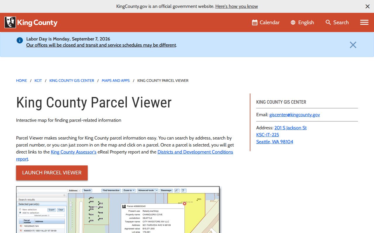
The map is the geographic start. Each linked Assessor report supplies the owner and address fields that must be read separately.
iMap adds Enhanced Search, more than 100 layers in grouped menus, aerial basemaps, political boundaries, planning, zoning, flood, and natural-resource context. Both a layer group and its individual layer may need to be switched on. Share links can preserve the map extent, which is useful when two relatives are checking the same Kent block.
Map Kent Neighbors Step by Step
A small, repeatable process is safer than copying a long list of names. Define the study area first, perhaps the two adjoining parcels and those directly opposite. Record the date and the physical site address for each lot.
- Enter the known address in Parcel Viewer and confirm that the city or district report fits Kent.
- Click the subject parcel, then each adjacent polygon in a consistent clockwise order.
- Open eReal Property and save parcel, owner or taxpayer, site address, and mailing address separately.
- Mark an owner as possibly local only when the mailing and site evidence agree; do not call that proof of occupancy.
- Add voluntary neighborhood or Block Watch contacts only from the program that published them.
A legal description can keep a parcel stable even when a postal label, street number, or mailing address changes. Parcel means a mapped unit of land. Situs means its physical site address, while the mailing address is where the tax notice goes. To trace every property along a full road, switch to the Kent by-street records workflow rather than stretching a block search beyond its purpose.
Reading Kent Owner Records
The Assessor report can show taxpayer or owner, mailing address, site address, parcel number, legal description, plat, block and lot, present use, year built, building facts, value history, and sales history. The report is parcel-centered. It does not state who else lives at the address. A trust, company, estate, or multiple owners may appear instead of one resident's name.
| Field | What to Record | What Not to Assume |
|---|---|---|
| Taxpayer or owner | Exact name and ordering | That every owner occupies the site |
| Site address | Physical Kent parcel location | That it is also the mailing address |
| Mailing address | Tax correspondence destination | That it is another owned parcel |
| Parcel and legal description | Stable land identifiers | That street labels never changed |
| Sales history | Dates and recorded transactions | That a sale names all occupants |
If an address search fails, retry the ten-digit parcel number without spaces or hyphens, or call the King County Assessor at 206-296-7300. Owner-name search was not confirmed as a stand-alone current eReal interface, so begin with the address or parcel. This is a key limit in any Kent neighbors search.
Kent Blocks Cross Many Boundaries
Kent is commonly described through East Hill, the Valley, and West Hill. County health reports instead use Kent-Central, Kent-East, Kent-South, and Kent-West. Neither scheme is the same as a postal ZIP, voting precinct, council district, neighborhood-council boundary, or parcel jurisdiction. A 98042 address, for example, may require a city-limit check because that ZIP reaches Kent, Covington-edge, and unincorporated service geography.
The Districts and Development Conditions report can list jurisdiction, ZIP, watershed, drainage basin, voting district, County Council district, congressional and state districts, school district, fire authority, and sometimes an annexation area. It explains which public body serves Kent neighbors, but it is a geography report rather than a people list.
Boundary check. A Kent mailing city does not by itself prove that the parcel sits inside Kent city limits.
Kent Voter Records Are Limited
My Voter Information asks a registrant for any three of first name, last name, date of birth, and house or building number. It is not a street-wide search. Current precinct and registered-voter lists can be public under RCW 29A.08.720, subject to RCW 29A.08.710, confidentiality rules, and the use restrictions in RCW 29A.08.740. Contact King County Elections for the lawful request channel rather than trying to defeat the personal lookup gate.
A voter record can contain name, residence and mailing addresses, registration status, precinct, and district information. Full birth date, driver's-license details, signature, and ballot choices are not a public neighbor directory. Washington also does not register voters by party in the ordinary statewide sense. Never infer political affiliation from a block list.
Most important, registered voters are not every Kent household member. Some eligible people do not register. Children and other residents do not belong on the roll. Address Confidentiality Program participants can be withheld. Treat voter data as one dated registration record, not proof of present occupancy.
Kent Neighborhood Councils Connect Blocks
The Kent Neighborhood Program recognizes resident-led councils with mapped boundaries. The program gives neighborhoods a route to city information, meetings, grant activity, and newsletters. Recognition materials call for an open membership area, a defined map, bylaws, officers or contacts, and documentation of outreach. These are voluntary community records, not public rolls of all Kent neighbors.
Kent Neighborhood Program
Use the city program for recognized-council boundaries, city liaison information, newsletters, and council contact routes.
King County GIS
Use parcel and district layers when a council boundary or mailing label does not answer the land question.
City Clerk
Ask for identifiable city records by department, date range, address, meeting, or program under the Public Records Act.
A newsletter recipient, officer, or event volunteer chose to share a role. That role should not be expanded into a statement about everyone at an address. Ask the council to forward a message when direct contact data is not published.
Kent Block Watch Uses Consent
Kent Police Community Education supports Block Watch through two city sectors. The program helps residents organize, receive safety information, and form a voluntary phone tree or contact network. It is a better path for a shared safety concern than compiling names from unrelated records.
Start with the city sector contact, confirm the group's local organizer, and ask how notices are shared. Let each household opt in. A phone tree belongs to the group and should stay within its stated purpose. Police reports are a separate records channel and may redact victims, witnesses, juveniles, and protected addresses.
Block Watch does not prove that its roster is complete or current. New arrivals may not have joined, and long-time Kent neighbors may decline. The strength of the program is direct consent and local context, not universal coverage.
No Master List of Kent Neighbors
Commercial neighbor tools may combine stale address histories, phone data, and inferred relationships. Official sources are narrower but disclose their custodian and purpose. The difference matters when a same-name result or old address could point to the wrong person.
| Approach | Strength | Limit |
|---|---|---|
| County parcel records | Traceable parcel, owner, and report date | Ownership is not a household roster |
| Election channel | Official registration context | Restricted use and incomplete household coverage |
| Voluntary local group | Consent and block context | Membership is optional |
| Commercial compilation | May combine broad sources | Unknown freshness, inference, and correction path |
The practical rule is simple: prefer the record whose keeper can explain and correct it. A failed search is not proof that nobody lives there. It may reflect a renter, protected record, unregistered resident, recent move, or database lag.
Note: RANS sends alerts about new recorded documents by name or parcel, but it neither lists neighbors nor prevents property fraud.
Kent Geography Changes the Search
A modern dense block can sit where older sources described a farm, river crossing, rural route, or a place name such as Titusville, White River, or Duwamish. Kent incorporated in 1890, and the 1906 White River diversion changed the valley's geography. Those facts explain why historical papers and current parcel labels do not always line up.
For past neighbors, Kent Library newspaper microfilm reaches back to the Kent Advertiser in 1893 and includes later Kent titles into the 2000s. Greater Kent Historical Society holds photos, school materials, oral histories, maps, public and personal papers, and Japanese heritage material. These sources can describe a community at a given time, but should not be used as a current contact list.
Kent's wartime history requires special care. About 200 Japanese American families lived locally by the 1940s, and forced removal in 1942 caused a stark break in farm and household records. Only about 30 families returned after the war according to city history. A gap in names or land occupation may reflect forced displacement, not an ordinary move.
Privacy Limits for Kent Neighbors
Washington's Address Confidentiality Program under chapter 40.24 RCW gives eligible participants a substitute mailing address and protected voter and marriage options. Their real residential address, precinct, and related location facts can be confidential. State and local agencies generally accept the substitute address for new records. Older public records may still exist, but they are not a license to reconstruct a protected person's location.
Utility customer lists, delivery data, and unlisted personal contacts are not public household directories. Assessor records omit most renters and non-owner household members. Neighborhood rosters are voluntary. When public information conflicts, ask the source office to correct its own record rather than publishing an accusation or guessing who lives at the property.
Lawful use. Find Kent neighbors for respectful community contact, reconnecting, or safety awareness. Never use records to watch, stalk, threaten, or harass anyone.